Kinnaur and Spiti
 Glacier at the top of Bhaba pass towards pin valley
 Face of the Pin valley getting broder downstream
 Some very technical ascents for adventure lovers on the way
 Imagine wandering in these grounds(3800mts.) for half of the year like shepheards!!!
Some of the ancient seats of Buddhist learning in the Western Himalayas are located in the tribal district of Spiti, hosting up to 200 monks at a time. Other important gompas are at Dhankar, Tanguid and Kungri.
With almost no rain but abundant snowfall, Spiti is a land of fascinating contrasts. Small habitation clustered along the glacial streams, shock of green in a barren expanse of Russet. Above the village, long wave-trains of prayer flags gently rise and fall with every gust of wind, sending the prayers of the people on wing to the mountain gods.
The stark beauty is on display for just about four months a year. For the rest Spiti is just under the blanket of white. In fact, its links to the rest of the world –the high passes and the solitary roads –cut off after a heavy snowfall. During a particularly harsh winter, the Spiti River is known to freeze over, encouraging some daring highlanders to skate on its iced surface. The inhabitants remain mostly indoors to conserve warmth, coming out to face the bitter cold only for bare necessities or to shovel the accumulated snow off the flat roofs. Their long sojourn within the walls is spent spinning and weaving, or simply trying to keep the smoldering fire going. Spinning and weaving are traditional skills from the bygone days of the pashmina trade, and have been kept alive by the need to combat the cold. Many layers of woolen are worn to trap the body heat, and even mules and yaks get their share of decorative cover. The colors used are maroons, brown and greens, shades that reflects the hues which nature has given to their land.
Bhaba valley supports diverse flora found in Himalayas and this is the last treeline before entering into trans-Himalayas

Kinnaur comprises the lower valley of the Spiti and the Satluj gorge. Probably predating in Himalayas themselves, the waters of the Satluj have held their ground over the ages, carving a route over the ranges as they inched upwards. The gorge is now thousands of feet deep, and offers difficult passage. Villages are perched on the higher reaches of this defile, where the slopes begin to ease. Tightly packed rows of houses cling to these hillsides in tiers, much alike as an amphitheatre. Nearby the thin strip of contour-hugging terraced fields, each barely sustaining a family with its produce. The larger land-holding of the village are actually at a much higher level, where the hillsides fan out into Rolling Meadows. Here at 3,000mts are the summer pastures for their flocks, along with the fields that yield the livelihood. The constraints of space and short summers have forced the Kinnauras to evolve some practical measures to maintain an optimal family. Polyandry is practiced in every household, but in addition only the elder brother resides in the village to look after the house and the fields. The younger inherits the wayfaring existence –that of the fwal –migrating from the high alpine pastures to the foothills along with his herds, much like the Gaddi. There isn’t any other community in the Himalaya that has achieved quite a same balance between an agricultural and pastoral life. This ability is evident in their religion as well, for Kinnaur is the meeting point of Hinduism and Buddhism. The villages has temples as well as gompas and all villagers, whether Hindu or Buddhist, participate in the events of both faiths. So to find an Uddho Singh turning a prayer wheel or a Tshering Dolma offering a flower to a local Devta comes as no surprise in Kinnaur.
The valley is dominated by the massif of Kinnaurr-Kailash, considered the abode of Shiva, where he conducts an annual conference with the other gods of Kinnaur. The giant rock lingam on a spur about 5,000mts (15,000 feet) attracts local pilgrims every year, and many perform the sacred parikrama around the entire range. Beginning on the left bank of the Satluj and passing through Charang, the yatra crosses Lalanti pass to Chitkul in the beautiful valley of the Baspa river, eventually following the trout-filled waters past the spectacular Kamru Fort to their confluence with the Satluj, a few miles downstream of the starting point.
Famous for its Chilgozas (pine nuts), Kinnaur also produces some of the best apples, almonds and apricots in the country. But what really puts this arid land on the world map is its exquisite anguri –the delectable local wine, made from a special grape cultivated in only in a handful of villages. Add to that the charm of the handsome Kinnauras, the music and the rhythm of the community lifestyle, the spectacular beauty of the gorge, and Kinnaur becomes irresistible.
Living in an ambience where sun and the moon govern the rhythm of the daily round, these hills people have established a unique relationship with gods that personify the elements. Regarded as more than mere symbols of divinity, the presiding deities of villages and valleys evoke a feeling of camaraderie rather than just worship, and are frequently summoned by individuals in the village for consultations regarding the sowing of crops, the sitting of a house, the marriage of a daughter or the settlement of a dispute. In such circumstances the local deity, usually with a recognizable face engraved in gold or silver, is carried on a palanquin from the sanctum to the residence of the needy villager, where a conversation ensues via the local oracle.
 Beas, flowing down with its glacial waters
 weawing Shawl is the major industry in Kullu valley
 Poplar and Cedar pine forest on the left bank of Beas river in Manali
 Rahala waterfalls on the way to Rothang pass
 A glacier on the right bank of Chandra river, on the way to Kunzum pass from Manali
 'Chandertal' - the moon lake.
 Upto Kunzum pass.
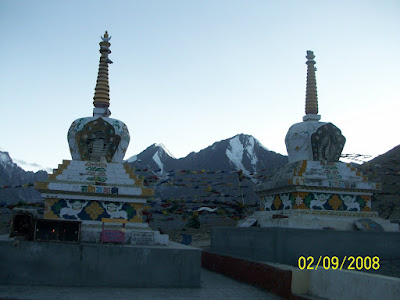 Kunzum pass. Elevation - 4551mts. from mean sea level.
 Losar village - the first permanent settelment after Manali.
 Dunes formed by glacial erosion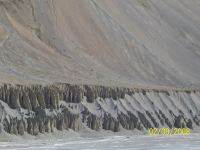
 Approaching Kaza, the divisional headquarter of Spiti
 A gorge at Kibber village
 Kibber village
 Traditional mud houses at kibber village
 Fresh snow fall at Pin valley
 A diverse alpine flora can be seen in Pin valley
 A ropeway is the common way of getting to the other side of Pin river
 Kungri monastery in Pin valley
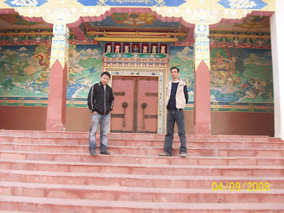 Its me on the right and my friend Jacob at Kungri monastery
 A lamp being lit up by using yak butter
 Leaving Pin valley
 Top floor of Dhankar monastery
 A gorge on the way to Nako village
 Sumdo, police check post
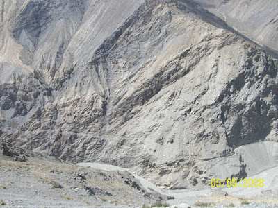
 Maling gorge
 Nako village, with fresh snow covered Himalayas in the background

 A life in safe hands..........
 A traditional house at Nako village
 A drive down to Khab
 Khab, the confluence of Satluej and Spiti river
 A valley bridge being built at Spello
 Goddess Bhima Kali temple at Sarahan
 Palace of Maharaja of Bushair Province

 Sarasawati, the goddess of knowledge
 Enterance of the Bhima Kali temple and end of our tour


 Peak name: Makalu
 Peak name: Dhaulagiri
  Peak name: Manaslu
 Peak name: Nanga Parbat


